Bishopscourt, Cape Town

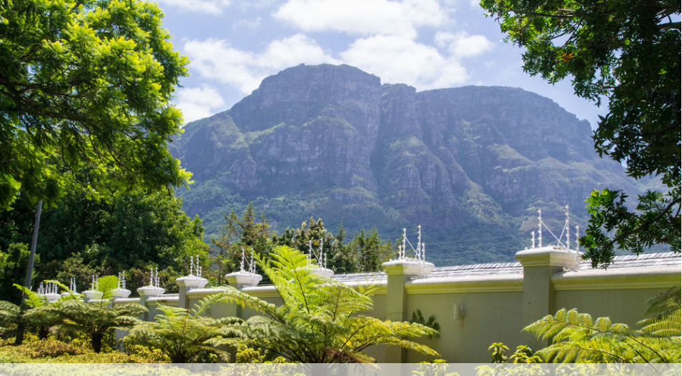
Set right against the slopes of Table Mountain in the Constantia Valley, Bishopscourt gives new meaning to the term ‘leafy’, which here describes incredibly large and gracious oaks that line most of the quiet streets with their large family residences, high walls and beautifully manicured gardens. Bishopscourt has an absolutely exquisite setting. No surprise then that a number of foreign embassies have chosen this Suburb as their home and a collection of Local and International celebrities too. These are multi-million rand Homes but the views alone are worth the price. Walks along the Liesbeek River, a popular local pastime, will take you past an Area of land along its banks that the Bishopscourt Village Residents Association, have rehabilitated and transformed the Area into a remarkable River Garden. This has undoubtably, re-establishing an important Ecological System and including over 100 indigenous trees.
Staying in Bishopscourt brings one to the heart of the Constantia Valley Region. On a clear day there are panoramic views over False Bay, which is close by and offers some wonderfully quaint beaches such as: 'St James and Danger Beach'. These Beaches in Cape Town are all exposed to pollution. This Area offers some wonderful local hikes, including Constantia Nek - probably more of a sedate stroll than a hike. Kirstenbosch, is nearby for a range of Hikes; including going up Table Mountain. The Yellowwood Trail and Silvertree Trail are longer hikes that take you up to the Waterfall and around the Estate, through both forest and fynbos. It is possible to climb Table Mountain from Kirstenbosch, up Nursery Ravine or Skeleton Gorge. Please note, this is only for experienced 'Rock Climbers'.
Bishopscourt is close to the Constantia Wine Route, Kirstenbosch Gardens and getting to the city centre is a matter of 15 minutes’ drive. Maynard Park in Wynberg. These Gardens have an open-air theatre that in Summer offers anything from Shakespeare to opera and is a favourite for the theatre-and-picnic brigade, known as; 'Maynardville Open-Air Theatre'.
Geolocation
-33° 59' 23.6908", 18° 26' 7.6807"

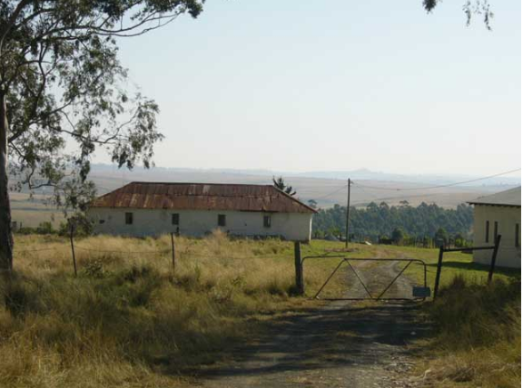
Luneburg, Kwazulu Natal

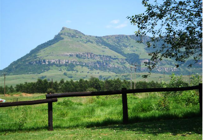
Lüneburg is located between the towns of Piet Retief and Vryheid on the border of the KwaZulu Natal Province and the Mpumalanga Province of South Africa, has grown into an agricultural region which farms Maize, Dairy, Beef, Pork and Timber. The little village of Lüneburg (place of the moon) is the original settlement of German Lutheran missionaries who, it is safe to assume, named the community in 1854 after their hometown in Germany.
Today it is the site of the oldest German school in northern KwaZulu Natal and lies in the northern Drakensburg, virtually on the border with Mpumalanga, its nearest neighbour Paulpietersburg. Lüneburg is essentially a farming community and its centre offers little by way of attraction (unless you include the two incredibly beautiful churches) which form the nucleus of the community, the town’s butcher and the farm cash store.
It’s what surrounds Lüneburg that makes this part of the world such an undiscovered treasure. Miles from society’s many creature comforts it is unavoidable that one gets in touch with one’s roots and instead soaks up the fresh mountain air, the enviable life that evolves from living close to nature and the strong sense of community that is Lüneburg’s society.
Life out here is subject only to the rolling hills, starlit skies, rivers that hypnotically wend their way through the valley, and the cry of the fish eagle. Angling for yellow fish is one of the ultimate pastimes here and it is safe to assume that the outdoors is what draws you here. Mountain biking, hiking, horse trails and birding are the main attractions, if one feels so inclined, but with the slowing down of time that is inevitable here, there is little pressure to do anything.
Geolocation
-27° 18' 57.6", 30° 36' 50.4"

Luckhoff High School

With being established in 1935, the school is a very important part of the Stellenbosch Community. It has produced great South Africans.
OUR VISION
Lückhoff High is committed to the principle that all children, regardless of their income or the class status of their parents, shall be guaranteed a quality education that empowers them to be whole, empathetic beings, able to live their lives justly, equally and with dignity.
OUR MISSION
Lückhoff’s mission is dedicated to foster the growth and development of committed, responsible citizens who are able to act with awareness of social, political, economic and environmental issues – who are sufficiently committed to the values of equality, justice and human dignity.
OUR VALUES
Democracy
Equality
Respect
Social Justice & Equity
Non-Racialism & Non-sexism
The Rule of Law
Ubuntu [Human Dignity]
TO ACCOMPLISH OUR VISION, LUCKHOFF HIGH WILL :
Continuously and consciously strive to pursue our vision
Value the participation of teachers and students (all role players) in the decision making process
Make decisions that are in the best interests of our students, education and the development of our community
Provide staff and students with the resources to achieve our vision
Encourage a spirit of team work, co-operation and a spirit of unity and community service
Communicate openly, honestly and appropriately while working co-cooperatively with all relevant institutions (local government, churches, NGOs, etc.) and the community
Recognise and celebrate all student and staff accomplishments
Provide a safe and secure learning environment
Promote a culture of dignity, equality respect and tolerance for all
Pursue consistent policies of attendance and discipline in the belief that these are essential to the delivery of quality education.
Geolocation
-33° 55' 8.5282", 18° 53' 5.8602"

Buntingville, Eastern Cape

 
The South African mission stations of Buntingville and Old Bunting, founded in the Eastern Cape in the nineteenth Century, were named after Sidney Percival Bunting’s great grandfather, Dr Jabez Bunting.
Old Bunting is a populated place and is located in OR Tambo District Municipality, Eastern Cape, South Africa. The estimate terrain elevation above seal level is 639 metres.
One of the most cherished District dreams is to turn all old mission stations into Hospice Centres for the disabled, Aids orphans and victims of abuse. An HIV/AIDS Centre has already been started at Buntingville under the supervision of the District Health Task Team Coordinator.
The church and community, have embarked on this project with great enthusiasm! The Health Task Team jointly with the District Mission Unit have been tasked to work hard to make the stated dream a reality!"
Geolocation
-31° 23' 24", 28° 6'

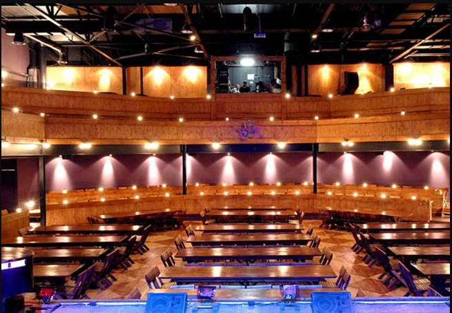
The Space Theatre

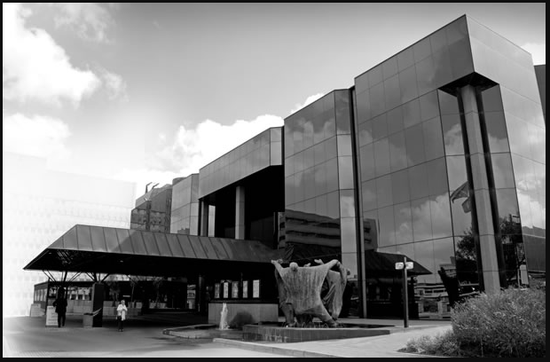
In 1970 Brian Astbury, a Professional Photographer, was hired to take rehearsal photos of Athol Fugard, Yvonne Bryceland, Val Donal and Wilson Dunster who were working on a production called ‘Orestes’.[i] Astbury ended up spending more time with the group and followed them as they performed in various venues.[ii] He was inspired by the work they did and felt the desire to open up a theatre space where similar plays such as Orestes could be performed.[iii]

After partnering up with the Architect, Maciek Miszewski, Astbury’s idea grew bigger and soon they were looking for Buildings and working on Theatre design plans.[iv] Finances were a struggle, but Astbury was fortunate enough to have had contacts in the right places and funding for the Theatre was collected under a Charity Foundation called the Foundation for Art and Theatre.[v] After a long search, they finally found a venue - the Sebba and Co building on Bloem Street in Cape Town.[vi] An abandoned building which was previously used for chrome and electroplating work [vii] and owned by Raymond Sebba, a Theatre enthusiast, met with Astbury and Miszewski who then offered them a deal for the top two floors.[viii]

On the 1 January 1971 they moved into the Building and three months later opened their first Production ‘Statements after an Arrest under the Immorality Act’ on the 28 May 1972.[ix] In 1973 they added an Art Gallery in the Building and in 1974 they opened a second venue on the ground floor. In 1976 The Space moved to the YMCA building in Long Street and became known as the first non-racial Commercial Arts venue to operate during the plight of Apartheid.[x]

In order for The Space to play to Non-Racial Audiences it used the guise of being a ‘Club’ where people could sign up and become Members, making it legal.[xi] The Space hosted regular Visitors such as  Pioneers in the Arts like Athol Fugard, Pieter-Dirk Uys, Barney Simon, John Kani and Blaise Koch, to name a few, and whom also performed and showcased their works at the Theatre.

The Argo Film Circle lent a helping hand in this endeavour and enabled The Space to successfully operate as it desired too.[xii] The Space was also one of the very first stages that hosted the collaborative productions by John Kani, Athol Fugard and Winston Ntshona, ‘Sizwe Bansi is Dead and The Island.’

It was recognized as the first Pioneer Fringe Theatre. It  was taken over by Moyra Fine and Rob Amato and became known as The People’s Space. In 1979, due to long-term financial challenges and ever dwindling audiences, The Space was Shut down. There had been more than three hundred productions staged.[xiii]

In late 2008, it Re-opened its doors with the support and encouragement of its’ Founding Members and supported by the Cape Town City Council, Inner City Development Programme.

Currently, The Space Theatre has released a Documentary depicting the stories of the People and Artists who fought to keep the Theatre running during the Apartheid Regime. The Space strove to Present and Host performances that challenged and defied the Socio-Political Conditions, in South Africa. The Documentary looks at the dangers of apathy, ignorance and the allowing of Governmental powers to strip away the rights of any individual. It also looks at the dangers of censorship and highlights the importance of all forms of arts as a means to educate, encourage and foster a community of open debate and discussion.

End Notes

[i] Brian Astbury, “The Story of The Space”, Theatre of Survival, Accessed 17 April 2017, https://theatreofsurvival.wordpress.com/2015/02/04/genesis//a>

[ii] Ibid

[iii] Ibid

[iv] Brian Astbury, “The Story of The Space”, Theatre of Survival, Accessed 17 April 2017, https://theatreofsurvival.wordpress.com/2015/02/15/a-bigger-photographic-studio/

[v] Ibid

[vi] Ibid

[vii] Ibid

[viii] Ibid

[ix] Temple Hauptfleisch and Miriam Terblanche, “ESAT Bibliography”, The Encyclopaedia of South African Theatre, Film, Media and Performance, 25 January 2017, http://esat.sun.ac.za/index.php?title=South_African_Theatre/Bibliography.

[x] Ibid

[xi] Brian Astbury, “The Story of The Space”, Theatre of Survival, Accessed 17 April 2017, https://theatreofsurvival.wordpress.com/2015/02/16/this-couldnt-have-cost-much-2/

[xii] Ibid

[xiii] Brian Astbury, “The Story of The Space”, Theatre of Survival, Accessed 17 April 2017, https://theatreofsurvival.wordpress.com/2015/02/05/prequel/

Geolocation
-33° 55' 15.6", 18° 25' 4.8"
References

Astbury, Brian. “The Story of The Space”, Theatre of Survival. Accessed 17 April, https://theatreofsurvival.wordpress.com/some-of-the-stories-of-the-spacedie-ruimteindawo/the-story-from-the-beginning/.|Hauptfleisch, Temple and Terblanche, Miriam. “ESAT Bibliography”, The Encyclopaedia of South African Theatre, Film, Media and Performance. 25 January 2017, https://esat.sun.ac.za/index.php?title=South_African_Theatre/Bibliography.|https://thespacetheatre.com/index.html (Accessed 4 April 2017)

The Company Gardens, Cape Town.

When the Dutch first settled in the Cape in 1652, Governor van Riebeeck's brief included the construction of a fort and the setting out of gardens where vegetables and fruit trees could be grown. The site for these gardens was chosen close to the so-called Sweet River, a little south-west of the present Parade. By 1660, its area occupied some 18 hectares of land and it extended from Tuyn Street, now Church Street, towards Table Mountain, and coincided more or less with the lower part of the present gardens. A trip to the Mother City would perhaps not be complete without a visit to the Company's Garden in Cape Town city centre. Home to historic buildings, museums, places of worship and an art gallery, it is also simply known as the Cape Town Gardens.

The whole area was enclosed by a thick hedge of ash trees and brambles. As the new village began to take form, a number of incursions began to be made upon the area of the gardens, with spaces being carved out for the slave lodge and a new church and graveyard. In 1679 the arrival of Governor Simon van der Stel brought about a number of changes in the nature of the garden. Other properties in the vicinity of the town were now growing so much produce that its function as an orchard and vegetable garden was no longer essential to the Company, and it was slowly converted into a botanical and ornamental garden. According to accounts of that time, it was divided into rectangular blocks by hedges, which also served as windbreaks. Some of these blocks were retained for the planting of vegetables, while others were dedicated to herbs, fruit trees, indigenous plants and exotic trees. The plan was divided by equally spaced avenues and at the top of the Gardens there was a water mill fed by a mountain stream. The northern side was enclosed by a high wall with a fine entrance gateway and important visitors to the Cape were accommodated in a small summer house erected by Simon van der Stel. During the 18th century the garden was gradually extended in the direction of Table Mountain including the establishment of a zoo at its top end, and it probably reached its present boundaries in about 1790. Apart from this expansion, a fine ornamental gateway designed by Thibault was added and the summer house, with its own private garden, and had been given over to the Governor as his residence. Following the British annexation of the Cape in 1806, the talents of Thibault, Schutte and Anreith were again combined to build the southern entrance and the so-called "Lion Gateway" to the zoo. During the 19th century added areas of the gardens were excised, when Government House was enlarged, and a portion of land was granted to the Anglican Church for the erection of St George's Cathedral. In 1832 Thibault's entrance from the city was demolished, and in the 1880s, large areas were taken over by Parliament House and the Public Library. More recently, the Museum, Art Gallery, the South African College and a number of monuments and other structures further reduced its space. Government Avenue was declared a National Monument under old NMC legislation on13 August 1937, while the entrance, walls and gateways on the southern side of Government Avenue, in Orange Street, were proclaimed on 6 January 1961.

Geolocation
-33° 55' 36.2617", 18° 25' 0.3659"

Zorgvliet Wine Estate, Stellenbosch

Seven kilometers outside Stellenbosch in the heart of the wine lands you will find a place of serenity and ultimate beauty
Wine has been a product of the Valley since the first white man settled there.  Vine cuttings were sent to the first commander of the Cape, Jan van Riebeeck, from Germany’s Rhineland in 1654 but arrived rotten.  Another batch, sent in the following year, proved to be the root and foundation of the wine industry.  The first wine was produced on February 2, 1659 and Van Riebeeck wrote joyously in his diary:"Today, praise be the Lord, wine was made for the first time from Cape grapes."
From the beginning life was hard.  Lions and leopards roamed the mountains, and living conditions were primitive.  The first parties were simply given government provisions, the plants to make temporary homes, and much encouragement.  The settlers, thrown back on their own ingenuity, courage and resourcefulness, created a hardy, independent and self-sufficient lifestyle based on their strong belief in God and the land.
Banghoek was originally known as ‘De Bange Hoek’ which is how it was indicated on a transport map of Zevenrivieren in the year 1704.  Not only was it dangerously steep but there were gangs, escaped slaves, lions, leopards and other wild animals in the dense forest area. Travelers were wary of this area because many were attacked by these animals and slaves that escaped from prison and thrown into the river.  Apparently you still find leopards in these surrounding mountains today.
 
The road from Stellenbosch originally ran through Idasvallei over the farm Nazareth – today Glen Bourne – to the top of the neck at the farm Die Hel, whose name later became Rust and Vrede now known as Kylemore, over Bethlehem and through the Groot Drakenstein.
The owner of Die Hel made his income from toll money and accommodation to farmers making their way to and from the Cape. Today Banghoek is a proud sub region of Stellenbosch. Zorgvliet Wines is proud to be part of this history.
Geolocation
-33° 54' 43.7329", 18° 56' 8.0697"

Auwal Masjid, Cape Town

The Auwal Masjid, is the first and oldest Mosque built in South Africa. This is evident according to very strong oral tradition which also confirms that Imam Abdullah Kadi Abdus Salaam, also known as Tuan Guru, was the first Imam at this Masjid.
The Auwal Masjid came into existence in 1794 during the first British occupation of the Cape of Good Hope and was the main religious institution during the years 1804 until 1850. It is also the first to have practiced most of the Cape Muslim traditions.
The Auwal Masjid, which is situated in Dorp Street, has always been a symbol of the struggle of Cape Muslims for the recognition of Islam and their freedom to worship. The mosque was built on land belonging to the freed slave Coridon van Ceylon.
On September 26, 1794, a Vryezwarten [Free Black Muslim], Coridon of Ceylon by name, purchased two properties in Dorp Street, Cape Town. Coridon was the first Muslim to own properties in Cape Town. On his death, his wife, Trijn van de Kaap, inherited the properties, as he had willed. In 1809 Trijn sold the properties to her daughter, Saartjie van die Kaap. In this regard, Saartjie, a remarkable woman, made land available for the building of a masjid (or Mosque), which was first constructed in 1794 with additions in 1807. A structural change - the construction of a mihrab [niche] indicating the direction of the qiblah - was made in order to convert the warehouse into a masjid. This masjid was established during the era of slavery, and established its roots in a climate of social and political prejudice.
According to Achmat van Bengalen the construction of the Auwal Masjid was made possible through General Craig who, for the first time, permitted Muslims to pray in public in the Cape Colony. The Auwal Masjid, situated in Dorp Street, Cape Town, became the first to be established and is still functioning as the noble founders had intended. It became a centre of Muslim communal activity, regulating and patterning their social and religious life.
The second site [adjacent to Auwal Masjid] is presently occupied by the family of the late imam of the Auwal Masjid, Imam Gasant Achmat Gamja [Hasan Ahmad Hamzah] [d 1981], a descendant of Corridon of Ceylon. Prior to the construction of the "Saartjie Masjid", the construction of masjid [sing masjid] and open freedom of worship were strictly prohibited in the Cape. The only "Kerk" [Church] permitted in the Colony was that of the Dutch Reformed Church. It was only in 1936 that extensive renovations were made to the Auwal Masjid. 
Geolocation
-33° 55' 19.2", 18° 24' 43.2"