Cairo, Capital City of Egypt

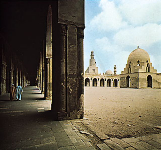
It is also the 19th largest city in the world, and among the world's most densely populated cities. On the Nile river, Cairo is famous for its own history, preserved in the fabulous medieval Islamic city and Coptic sites in Old Cairo. ... Since the revolution in 2011, the tourists have fled Cairo to a large extent. No visit to Cairo would be complete without a day trip to the Pyramids of Giza, perhaps the most famous ancient site in all of Egypt. Located approximately 20 kilometers west of the city center, the Giza pyramid complex comprises the Pyramid of Khafre, the Pyramid of Menkaure, and the Great Pyramid of Khufu. Cairo became an important centre of Islamic learning. ... Under the iconic Nasser, Cairo developed into a modern metropolis with Egyptians from all over the country pouring in. It eventually became the largest city in the Islamic world, and one of the biggest in Africa.  Egypt’s capital, holds the special distinction of being home to the only one of the Seven Wonders of the Ancient World still standing: the Great Pyramid, completed around 2540 B.C. It’s part of a six-pyramid complex just outside the city on the Giza Plateau.
 
Not quite as old, the nearby Citadel was built on a hill by the caliph who defeated the invading Crusaders in the 12th century. The Citadel is famous for its views over Cairo, as well as for being the site of the grand Mohammed Ali Mosque. Built in the 1800s, the mosque is one of the first buildings visible when approaching the city. With its Ottoman-influenced architecture, the mosque resembles the Blue Mosque of Istanbul, another monument of Islam.
 
The history of Christianity in Egypt dates to just a few decades after Jesus died. During the Roman era, St. Mark is believed by scholars to have come to Alexandria to spread the gospel through Egypt. Cairo’s oldest area is the Coptic Christian area, which has five churches, the first mosque built in Egypt, the oldest synagogue in the country, and the ruins of Roman fortifications. Built on an old Roman fortress, the Hanging Church (so named because the nave was built between the ruins of two towers) has 110 religious icons; the oldest dating back to the eighth century.
Nile River is the longest river in the world, called the father of African rivers. It rises south of the Equator and flows northward through northeastern Africa to drain into the Mediterranean Sea. It has a length of about 4,132 miles (6,650 kilometres) and drains an area estimated at 3,349,000 square kilometres. Its basin includes parts of Tanzania, Burundi, Rwanda, the Democratic Republic of the Congo, Kenya, Uganda, South Sudan, Ethiopia, Sudan, and the cultivated part of Egypt. Its most distant source is the Kagera River in Burundi. 
 
Geolocation
30° 37' 48.4529", 30° 54' 7.804"

Clarens, Eastern Free State

Clarens, a small Town situated in the Eastern Free State which was established in 1912. The Village of Clarens, was a result of two Farms being sold; 'Leliehoek' and Naauwpoort'. The two Farms were then divided into plots and sold for fifty Pounds each! This became a Village and was named Clarens after the History that President Paul Kruger was in voluntarily exile for his his last days in the Town of Clarens, in Switzerland!
Clarens often referred to as a ‘jewel’ of the Free State, and one such ‘jewel’ is it’s Titanic Rock. The most notable sandstone cliff in the Area and is situated just 2 kms North of Clarens. The uniquely shaped rock forms part of Clarens History as it was named by a resident, after the Titanic ship tragically sunk. This was so named due to its remarkable resemblance and being shaped like the bow of the ship!
Many of the Homes and Buildings in Clarens are built using local sandstone, giving them a particular appeal. The Artists' Amble is a route that takes in the local art Galleries run by and supplied, by local artists. A great variety of fossils from teeth, claws and limb bones indicate that there were prehistoric giants of dinosaurs that roamed in the Town before the bush men, who were the first people to dwell in the Town came into the scene. As evident of Khoisan Hunter gatherers shown on the Town’s, rock art.
 
Geolocation
-28° 30' 50.0816", 28° 25' 5.5515"
References
https://clarens.co.za/2018/05/14/surrender-hill-clarens-free-state/

Windhoek, Capital City of Namibia

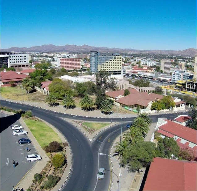
Windhoek is the capital and largest city of the Republic of Namibia. If Namibia is Africa for beginners, then Windhoek is very much its capital in more than name only. It's the sort of place that divides travellers, with those who love it for the respite it offers from the rigours of life on the African road facing off against those who find it a little too 'Western' for their African tastes. And they're both right: Windhoek is a modern, well-groomed city where office workers lounge around Zoo Park at lunchtime, tourists funnel through Post St Mall admiring African curios and taxis whizz around honking at potential customers. Neo Baroque cathedral spires, as well as a few seemingly misplaced German castles, punctuate the skyline, and complement the steel-and-glass high-rises. The population of Windhoek in 2011 was 325,858, growing continually due to an influx from all over Namibia.
Windhoek, the capital of Namibia, is located in a basin between the Khomas Highland, Auas and Eros Mountains. It is 1,680m above sea level, 650 km north of the Orange River and 360 km from the Atlantic seaboard. Whether due to pure luck or a brilliant stroke of Germanic planning, the city is situated in almost the countries epicenter. This location has obvious benefits when it comes to governing a country the size of Namibia, and also makes it the ideal place to start and plan any Namibian travel.
The majority of tourists visiting Namibia on a fly drive safari start their adventure in the capital as it is the main entry point to the country. There are several large international companies offering rental cars at Windhoek International Airport while numerous smaller companies offer vehicle hire in Windhoek.
In 2013 the population of Windhoek was approximately 342,000 people, an extremely small capital by global standards. This number is growing rapidly at present mostly due to a lack of employment in rural areas. Despite the large increase in population over the last few years the city centre is extremely clean, and mostly trouble free. Most tourists comment on the cleanliness of the city!
The city centre is characterised by a proliferation of German style buildings, a lasting reminder of Namibia's early colonial history. Early buildings such as the Alte Feste (old fort), Christuskirche and Tintenpalast (the parliament buildings) are of particular historical interest. In a wonderful display of irony, the Alte Feste Fort, once the bastion of German colonialism, now houses the National Museum which places particular emphasis on the freedom struggle and Namibian independence, right in front of the fort is the iconic Reiterdenkmal (equestrian memorial). Other notable buildings in Windhoek include St Mary's Cathedral and the Turnhalle Building.
 
Windhoek has had several names, many inspired by the hot water springs found in the area, the earliest of which were the Damara /Ais //Gams (/ indicates a click in name spelling) which means firewater and the Herero Otjomuise or place of steam. The area was also called Queen Adelaide's Baths for a (mercifully) brief time. Several opinions are offered for the origin of the present name, the most popular of these is that sometime before 1840 Jonker Afrikaner, a Nama leader, named the area Winterhoek, after the farm in South Africa where he was born. Windhoek, or windy corner, is a corruption of this name.
 
During the day the city centre has a European cafe culture, German cuisine dominates, but Namibian influence can be found in the quantity and quality of meat on offer, (vegetarians be warned, Namibia is carnivorous country!) Saying that, the streets are choc-a-bloc with people of all ages and cultures, all bearing a wonderful sense of pride, hope and ambition.
Nightlife in the city centre has grown with the population, with a decent amount of restaurants, bars and night clubs. There is still a fair amount of nightlife happening outside of the city centre, in the suburbs and in township areas. During South African occupation the city was divided into three areas; the central suburbs for the Whites, Khomasdal for the Coloureds and Katutura for the Blacks. Katutura and Khomasdal have a vibrant nightlife and over the weekends the partying is non-stop. For the uninitiated visiting one of these disadvantaged areas can be extremely daunting (and unsafe), but with a little local guidance you could be in for the time of your life.
 
Most importantly Windhoek is home to Namibia's brewing industry, and for the less active Windhoek is a great place to wile away the time while sipping (or gulping) a cold beer. There are also a number of private hospitals, a state run hospital, doctors surgeries, banks, (with 24 hr ATM's) pharmacies, supermarkets, bakeries, and clothes shops. There is a large(ish) shopping mall at Maerua Mall, (complete with indoor swimming pool and gymnasium) and a smaller one on Post Street Mall, (Town Square) and at Wernhill Park, all worth a visit, especially if you've had enough of looking at curios. There are also 2 industrial area, Northern and Southern, handy for bulk buying or car parts and repairs.
Windhoek's (and Namibia's) sense of progress since Independence, is emphasized by the presence of new offices, combined with expanding and bustling building and commerce industries.
There are plenty of places to stay both in and around the city, these range from backpacker hostels, through bed and breakfasts and guest houses to luxury hotels and lodges. Such apparent incongruities aside, Windhoek makes a great place to begin or break a journey through Namibia or rest at journey's end. The accommodation choices, food variety, cultural sights, shopping and African urban buzz give it an edge not found anywhere else in Namibia. Such apparent incongruities aside, Windhoek makes a great place to begin or break a journey through Namibia or rest at journey's end. The accommodation choices, food variety, cultural sights, shopping and African urban buzz give it an edge not found anywhere else in Namibia.
Geolocation
-22° 32' 42.8798", 16° 59' 41.0877"

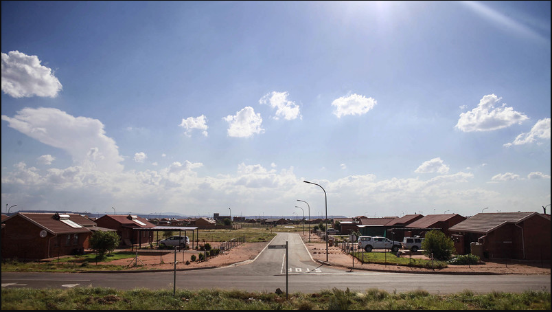
Siyathemba Township, Balfour

The Dipaleseng Local Municipality is a Category B municipality situated in the Gert Sibande District in the Mpumalanga Province. It is bordered by Lekwa and Govan Mbeki to the east, the Free State Province to the south, and the Gauteng Province to the west. It is the smallest of seven municipalities in the district. 
Balfour is the seat of the municipality and is its major town. It is situated approximately 80 km south-east of Johannesburg. The close proximity of the municipality to Gauteng allows for the spillover effects of development in Gauteng to be enjoyed in this municipality. The three major urban nodes in the area are Balfour/Siyathemba, Greylingstad/Nthoroane and Grootvlei. 
The major roads that transverse the municipal area are the N3, which runs from Johannesburg to Durban, and the R23 from Pretoria to Volksrust. The Johannesburg—KwaZulu-Natal railway system runs through the municipal area. Johannesburg - The town of Balfour, in Mpumalanga, is to be incorporated into Gauteng, local government MEC Humphrey Mmemezi said in Boksburg on Thursday.
"We intend taking Balfour to Gauteng," he said at a media briefing. "The people of Balfour have long wanted to come to Gauteng. They believe we are delivering services to the people."
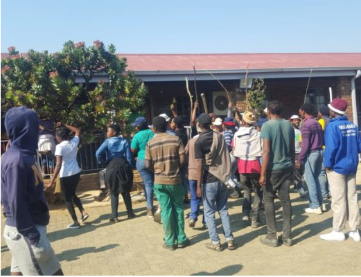
The town was the site of violent service delivery protests in 2009 and 2010. Residents burned down the library in the Siyathemba township in February last year, they also burned poles Eskom had planned to use in the area, looted foreigners' shops, and burned down a municipal office. There were similar protests in the town in 2009. President Jacob Zuma suggested the incorporation during a visit to the area last year.
A mere 300 km from the border of Namibia lies this new small town that’s growing exponentially — it is home to some of South Africa’s highest earners, at times surpassing those in Johannesburg and old-money Stellenbosch.
Geolocation
-26° 39' 4.4186", 28° 36' 29.3981"

Balfour, near Johannesburg

Whilst Balfour made recent headlines when Jacob Zuma visited the town in the midst of service delivery protests from locals in the Siyathemba township, and his subsequent return in May 2010, Johannesburg residents know the town because it lies plum in the middle of one of the closest areas for weekend breakaways. Located south east of Suikerbosrand Nature Reserve, just off the R23 that leaves the N3 north of Heidelberg and heads into the province of Mpumalanga, Balfour nestles in a region given over mostly to farms, game farms and bushveld. Balfour is a small coal mining and maize farming town originally called McHattiesburg after the man who founded it, Frederick McHattie. This was later changed and named for the British Prime Minister of the time, Arthur Balfour, after he gave a speech on the town's train station platform in 1905.
 
Balfour lies in what is known as Cosmos country, the south western area of Mpumalanga that is at the centre of the country's coal mining. It is called Cosmos Country because it is this area that annually explodes with varying pink and white cosmos flowers during autumn, a breathtaking sight for any visitor. It is also Big 5 country, and the grasslands, vleis and low lying hills provide not only the perfect space for cattle farming but also for various game farms. This makes a game spotting holiday close to home more than possible for Gautengers and fleeting visits to Johannesburg, ensuring that one gets a taste of the Bush without having to travel all the way to the Kruger National Park. This farming country and ideal for a leisurely stroll across the nearby koppies, especially when cosmos flowers are in full bloom during autumn. Life in the centre of town is quiet so it's well worth doing a private tour of the surrounding region, during which local guides narrate the history of the surrounding region that also stretches to Greylingstad, Val and Villiers. Along the winding banks of the Suikerbosrand River and situated on the Balfour Dam you'll find Fortuna Resort – a peaceful, privately-owned hideaway that is known for its camping and caravanning facilities, and quad biking track. The kids will be entertained by the putt putt golf course, playground, trampolines, heated and cold swimming pools and the possibility of catching any of the five freshwater fish species.
 
Few know about Balfour Dam along the banks of the Suikerbosrand River or Welgelegen Manor – the architectural landmark built by one of South Africa's greatest architects – both of which lie quietly in Balfour.
 
The most interesting historic landmark in the Balfour area is the Welgelegen Manor House. It was designed by none other than Sir Herbert Baker, the architect who designed the Union Buildings and Groote Schuur Hospital among numerous other buildings and historic landmarks. The restored manor house has been transformed into a five-star guest house and numerous recreational activities – such as walking, hiking and lawn sports – are centred here. Otherwise play a round of golf at Summerfield golf course close by. Balfour is certainly the town to visit if you have little else on your agenda besides reading and unwinding. 
Geolocation
-26° 38' 14.174", 28° 32' 50.9033"

Welgelegen Manor House, Belfour

Welgelegen Manor is the embodiment of the incredible life and ambition of industrialist and innovator, Andries Mostert.
Andries Mostert was born in Paarl in 1868 – but due to bad health, was schooled in Beaufort West. As a teenager, he began his working career in Kimberley, working for his brother who owned a butcher shop. But Andries knew his destiny was not in this family business, He wanted a chance to build real wealth and reclaim the much loved but lost Mostert Family Estates of Rondebosch, Cape Town.
His grandfather had sadly gone bankrupt when the dreaded vine disease, Phylloxera, ravaged the family estate vines and was forced to sell off the land which included a beautiful house named Welgelegen. Andries’ great ideal was to see his family back in their family seat – so he set off for Barberton to mine gold and build a future.
 
Discovering that the life of a miner was a difficult and low-paid one, he joined his brother at the Ferreiras Camp (Johannesburg) to build the railway line from Braamfontein to Elandsfontein. This resulted in him forming the A M Mostert Construction Company. This company went on to build many famous landmarks, including the Church Plain Pretoria, a canal in Doornfontein and numerous reservoirs – while he also sub-contracted on the Union Buildings. Now earning real money, he saw that his ancestral home ‘Welgelegen’ was for sale – but unfortunately he was outbid to it by Cecil John Rhodes who decided to renovate the house ‘for the premiers of the future’ – using architect Sir Herbert Baker.
Although he never realised his dream fortune fell on Mostert in other ways. In 1911 he bought the land between Balfour and Nigel and called the farm Rietbult Estate. The first thing he developed was a grand orchard and in 1912 he commissioned the famed architect, Sir Herbert Baker, to build a house in the same style as the lost family house. He named it Welgelegen in memory and is today as much as then, a symbol of his passionate commitment to preserving the heritage of a bygone era.
 
All of our luxury accommodation options at the Manor stay true to Welgelegen Manor’s classic English residential style. The eight suites fuse contemporary comfort with the timeless glamour and heritage associated with this historical property.
 
Geolocation
-26° 37' 27.0906", 28° 36' 46.3512"

Tsolo, Eastern Cape

(prior to 1910)

St Augustine's was established in 1865 by the Reverend Bransby Key as a station of the Society for the Propagation of the Gospel on Foreign Parts. It was located on the Inxu river, near the capital village of Chief Mhlonthlo of the amaMpondo. In 1874 the British Colonial Government offered to extend its "protection" in the Transkei to amaMpondo territory and, as a result, Mhlonthlo was persuaded to accept the appointment of Hamilton Hope as resident magistrate for his district. A second magistrate, Alexander Welsh, was posted with Chief Mditswa, an elderly kinsman of Mhlonthlo, whose village was on the Xokonxa river. Hope established his magisterial seat near St Augustine's, on a site known locally as Tsolo.

The name is of isiXhosa origin and describes a number of sharply pointed hills found in the region. In 1879 the Governor of the Cape, Sir Bartle Frere, attempted to implement a new policy which barred Black residents of the Colony from carrying weapons of any description. Understandably these measures were not welcomed by the people concerned, and within the year indigenous groups throughout the Transkei and Basutoland had united in common revolt.

Under the pretence of joining the British in a police action against the baSotho at Matatiele, Chief Mhlonthlo lured Hope and his staff to Sulenkama where, on Saturday 23 October 1880, they were massacred. The only person to be spared was Alfred Davis, son of Mhlonthlo's missionary at Shawbury, who was allowed to leave unscathed. Mhlonthlo and his warriors, now armed with 100 rifles captured from Hope, advanced towards Maclear.

News of the killings reached Tsolo later that day, and before riding off to Umtata for reinforcements, Welsh advised all concerned to fall back upon his residency at Mditswa where, he felt, they would be safe. The next day the party, which included the mission staff and the family of the local trader, were escorted by Chief Mditswa to his village where they took over the local jail, a small but substantial stone structure. Later in the day their number was augmented by the arrival of further refugees. Eventually their number included thirty five men, women and children of all races.

Despite repeated assurances on their safety from Mditswa, they remained penned in until the Saturday when a rescue party escorted them to Umtata. At the end of hostilities Mditswa was banished to Robben Island, while the magisterial seat, still known as Tsolo, was moved to a site near his village. In September 1894 the administration of West Pondoland was transferred to Griqualand East. The 1904 census indicated that Tsolo had a population of 241.

Geolocation
-31° 18' 17.4368", 28° 43' 17.8482"
References

Prepared by Franco Frescura.

Shipwreck Trail, Eastern Cape

ABOUT SHIPWRECK HIKING TRAIL
Start: Port Alfred 
Finish: Fish River Mouth near East London 
Duration: 69 km over five days 
Fitness: moderate 
Our tip: a six night version of the hike includes canoeing (fairly gentle paddle worth including in the hike); another includes an overnight in a game reserve at Lily Pad huts; there is also a slackpacker version of the hike
 
This six day, five night hike takes you along the Shipwreck Coast renowned for the number of ships that ended up on the rocks. The hike includes the sheer beauty of this wild, unspoilt strip of coast, beautiful estuaries, showering in the rough, cooking your food over a bush fire and a complete escape from civilisation. Overnight camps range from bush camps with a huge fireplace and basic dormitory-style sleeping to an historic, stone cottage and a treehouse suspended above a stream. Foam mattresses, cooking utensils and water are included. 
Despite its length the hike is not overly strenuous, covering between 7 and 14 kilometres a day. Days are spent walking the beaches of the coast whilst evenings are spent inland. Not all of the campsites are close to the coast and you can expect to hike as far as 5 km through riverine forest, or through farmlands to reach them.
The markers for the route are little sea anchors painted on wooden boards that hang from trees, although on the beach, trees are not a common occurrence and hikers rely more on landmarks for trail markers.
Shipwreck hiking trail is great for birding enthusiasts!
Geolocation
-33° 34' 33.0498", 26° 56' 8.6684"

Barnyard Theatre in Cape Town

Having been established 20 years ago, the Barnyard Theatre family is no stranger to hosting some of the best local bands, comedians and performers. From the hilarious Barry Hilton to the musical talent of the 'Parlotones' and 'Prime Circle', there is a wide variety of shows doing the rounds at the six venues found across the country.
There are conference packages available, with resources capable of catering for up to 300 or more delegates, while programmes can be customized to suit the needs of the company attending.
There is a pizzeria and facilities for buffets around the venues if guests are feeling hungry, while equipment for corporate functions include audio visual, a large stage and sound and lighting tools. The Barnyard Theatre is able to host product launches, staff parties, entertainment and fundraisers.
Friendship, good food, wine and brilliant entertainment – this is where it all comes together. The Mother City's first Barnyard Theatre is situated in Willow Bridge Centre. This is a dinner theatre at its best, offering excellent live entertainment including rock shows, musicals, bands and revues. 
The Barnyard started as a homely, rustic farm theatre in Plettenberg Bay where friends and family could be entertained and eat, drink and talk into the small hours of the morning. It proved to be such a winner that more Barnyard Theatres started popping up all over the Country. 
There are currently 12, Barnyard Theatres in South Africa. While each theatre is a product of its individual setting, they all retain the quaint rustic charm of the original farm theatre’s humble beginning. 
In the mood to be entertained... but not in the mood to get all dressed up and there's nothing on TV? Hungry... but not in the mood for cooking, washing dishes or dining at a formal restaurant either? Feeling homely.... but want to get out of the house? In a sociable mood … but want to stay intimate, perfect solution! The Barnyard Theatres offer professional upmarket theatre productions in a cosy, relaxed social environment where friendship, food, wine and brilliant entertainment all come together. Bring the kids if it’s a show that they would enjoy, meet some friends after work and share a few bottles of wine, host a birthday party, plan a weekend date, double date or a New Years Eve bash.
Doors usually open about and hour and a half before the show starts so that you can get comfy at your own wooden table, make yourself at home and have dinner. Pack a gourmet picnic, pick up something from a drive-through, take last nights leftovers, order your favourite Chinese take-out and bring some chop-sticks anything goes on the self-catered food front, no fuss. The bigger Barnyard Theatres have selection of pizzas, nachos and snack platters that you can order in advance and collect on arrival. No beverages are allowed as there is a full bar service catering for drinks (closed during the show) so be sure to stock up before the performance.
The theatres are non-smoking and kid friendly with smoking lounges for smokers. Shows include local and international plays and musicals, live bands as well as special circus productions. The stage, lighting effects, sound quality and performances are Broadway quality set in a rustic Barnyard inspired venue with wooden tables facing the centerstage. The shows are usually so much fun that you might want to be a part of them and since dancing is not allowed on the tables the production company hosts regular auditions for talent. 'Break a leg!'
Geolocation
-33° 52' 21.0061", 18° 37' 48"

Johannesburg Civic Theatre

Johannesburg’s Civic Theatre was built by the then city council in 1962, creating a high-profile landmark on the top of the Braamfontein hill. The building was given a magnificent face-lift in the late ’80s, turning it into one of the most technically proficient theatres in the southern hemisphere.
In the year 2000 – when theatres across the country were considered to be both creatively and financially moribund – the city council decided to corporatise the operating company of theatre, which is now a Municipal Entity of the City of Johannesburg.
The Johannesburg Civic Theatre (Pty) Ltd was given a Board of Directors, and Bernard Jay, a veteran UK born theatre producer and administrator who had relocated to South Africa in 1993, was appointed Chief Executive Officer of the company.
In July 2013 Xoliswa Nduneni Ngema, an experienced South African Theatre practitioner, was appointed as Chief Executive Officer. Nkopane Maphiri was appointed as chairman of the Board of Directors in March 2017.
Now in its 18th year as the operating company, “the Civic” – which morphed into the more street-wise and accessible Joburg Theatre in 2009 – has become one of the acknowledged success stories of Joburg City’s corporatisation policy. The complex’ largest auditorium, re-named The Nelson Mandela Theatre, regularly sees over 75% of capacity audiences and remains open a minimum of fifty weeks in each year.
In the past decade, The Mandela at Joburg Theatre has hosted many hit shows, including William Kentridge’s acclaimed interpretation of Mozart’s THE MAGIC FLUTE, the West End and Broadway musicals WEST SIDE STORY, CHICAGO, THE COLOR PURPLE and SPAMALOT and top-of-the-line global touring shows, such as LE GRAND CIRQUE, LORD OF THE DANCE and BRAZOUKA.
 
Joburg Theatre’s annual festive season pantomime productions, written and directed by Janice Honeyman, have become the most popular highlight of South Africa’s theatrical calendar.
Joburg Theatre is also permanent home to Joburg Ballet, Jill Girard and Keith Smith’s Peoples Theatre Company – performing throughout the year to children between the ages of 3 and 13 – and one of the country’s most respected community development projects in the arts, the tiny ‘black-box’ theatre known as space.com.
Geolocation
-26° 11' 27.1975", 28° 2' 19.0242"