Brandfort, Free State
It was established on the Farm in the Free State Province, named "Keerom" (which means "Turn around"). Settlers occupied the Area in the 1830's and the Town was proclaimed in 1874. It became a Municipality in 1884. The name "Brandfort" means "burning fort" or 'burning bean river' (in Afrikaans), after a plant which grows there! The main reason for this small Town is; agricultural and co-operatives for the Farming Community. It is located in the central Free State Province of South Africa, about 60 km North East of Bloemfontein.
It commemorates the Boer women and children (and also farm workers) who died in the Brandfort concentration camps during the South African War. Winnie Mandela had been banished to Brandfort on the 16 of May 1977. There she was unceremoniously dumped at house 802 with her youngest daughter, Zinzi.
In the book, Winnie Mandela: A life, she described Brandfort as: "A drab and dusty rural hamlet with unimaginative houses, an old-fashioned two-storey hotel, small shops lining the main street and a pervading atmosphere of lethargy and inactivity…
The dilapidated Township, had no official name but the Black residents had named it “Phathakahle” -meaning handle with care" The site has been nominated as a National Heritage Site and plans are underway to develop it into a Museum.
In South Africa, the first concentration camps were erected in early 1901 during the Anglo-Boer South African War (1899-1902), also known as the Second Boer War.
Segregation persisted during wartime and there was a camp for whites called Dwyersdorp (named after Captain Dwyer who assisted white women and children who had been incarcerated at the camp) and the adjacent one for blacks was called Nooitgedacht.
The camp Cemetery was declared a National Monument in 1985 and currently holds Provincial Heritage Site status. It contains the remains of 1263 women and children. The cemetery was opened on 22 September 1962 by President Charles Robberts Swart.
The Florisbad Archaeological and Paleontological Site, lies about 46 km West of Brandfort and the site was declared a National Monument (now a Provincial Heritage Site) in 1997. The Florisbad Skull, an early hominid from the Middle Stone Age, was found here.
The first aeroplane built in Africa was built in Brandfort on property owned by Rear-Admiral John Weston. It has been nominated a National Heritage Site by SAHRA. This is where John Weston lived and designed both the aeroplane and Gnome engine now exhibited by the Bloemfontein Museum. He also designed the first RV/motorised caravan in the world.
Cala, Eastern Cape
facebook-www.deanallen.co.za
http://calusa.co.za/history/#page-content
https://digitalcollections.lib.uct.ac.za/collection/islandora-30006
History Grade 11 - Topic 4 Source-based Questions

QUESTION 1: HOW WAS AFRIKANER NATIONALISM PROMOTED IN SOUTH AFRICA DURING THE 1930s TO 1940s?
History Grade 11 - Topic 4 Essay Questions

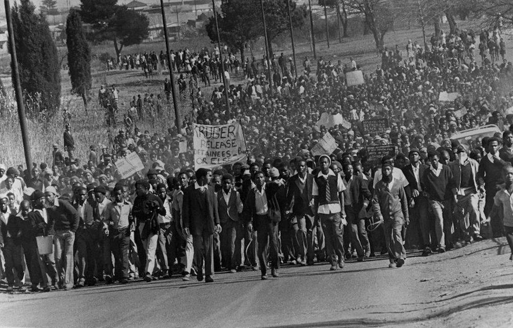
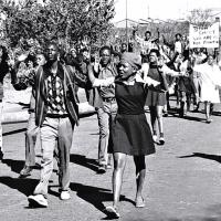
An image of bold, selfless youth in late 1970s South Africa inspired by the black radical consciousness philosophy. Image Source
Essay Question:
History Classroom Grade 11 Topic 4: Nationalism - South Africa, the Middle East, and Africa
History in Images
History Grade 11 - Topic 4 Glossary

Note: All definitions are acquired through Google’s online English Dictionary.
Nationalism: Nationalism is the feeling of belonging to a nation. Nationalism developed over centuries, from the earliest communities (lineages, tribes, etc.) through to the establishment of kingdoms and on to people rising up against these in order to create nations in which they had rights and could own property.[1]
History Grade 11 - Topic 4 Contextual Overview

Figure 1.1. With his call to put “America First”, Donald Trump is the latest recruit to a dangerous nationalism. Flagrantly authoritarian figures like Donald Trump are committed to exclusive notions of citizenship and command the support of vast populations. Image Source
Introduction:

