An Inconsolable Memory by Aryan Kaganof

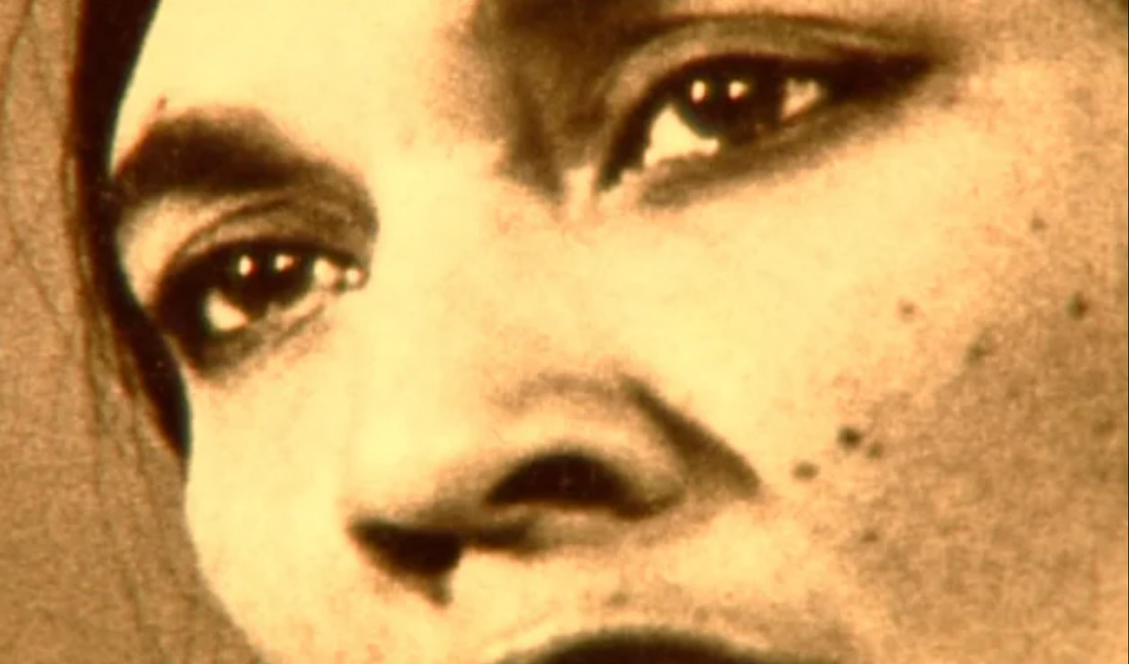
An Inconsolable Memory is Aryan Kaganof’s film about the Eoan Group. Combining rare archival film footage of District Six and Eoan’s opera performances with contemporary documentation and interviews, An Inconsolable Memory forges documentary narrative and poetic meditation on memory into a single compelling form. What was Eoan? What did it mean to the people who took part in its many productions? These questions propel Kaganof’s documentary, but form only the surface of a richer and deeply tragic story.

Language

Fort Glamorgan, East London

The Historical site of Fort Glamorgan in East London, named after the Earl of Glamorgan. Established in 1848 along the Buffalo River, this Fort was used as troop barracks and to guard the supply line to King Williams Town. The Fort was named after Lord Charles Somerset's father, the Earl of Glamorgan. Somerset was the governor of the Cape Colony. The original Fort consisted of a loop-holed wall, which encompassed the soldier's barracks, forage stores and stables, a Hospital and cookhouses. The original powder magazine was located outside of the Fort's perimeter. The British realized that this was a mistake, and a new magazine was built inside the grounds in 1856. The powder magazine was constructed of Dolerite blocks, and features an arched roof, surrounded by a high wall and adjoining guard house. The powder magazine is the only reaming building at the fort, and is situated about 500m from the main gate of the prison, and is only accessible through the main prison gates, Named a National Monument in 1938, the Building stands within the Glamorgan Prison grounds. Permission from the department of correctional services will need to be given before access to visit the fort will be granted.
Geolocation
27° 53' 38.4", -33° 2' 2.4"
References
https://www.sa-venues.com/things-to-do/easterncape/fort-glamorgan/ https://www.wheretostay.co.za/topic/3535-fort-glamorgan
Further Reading
https://tenderbulletins.co.za/gazette-tender/east-london-fort-glamorgan-prison-emergency-repairs-and-renovations/

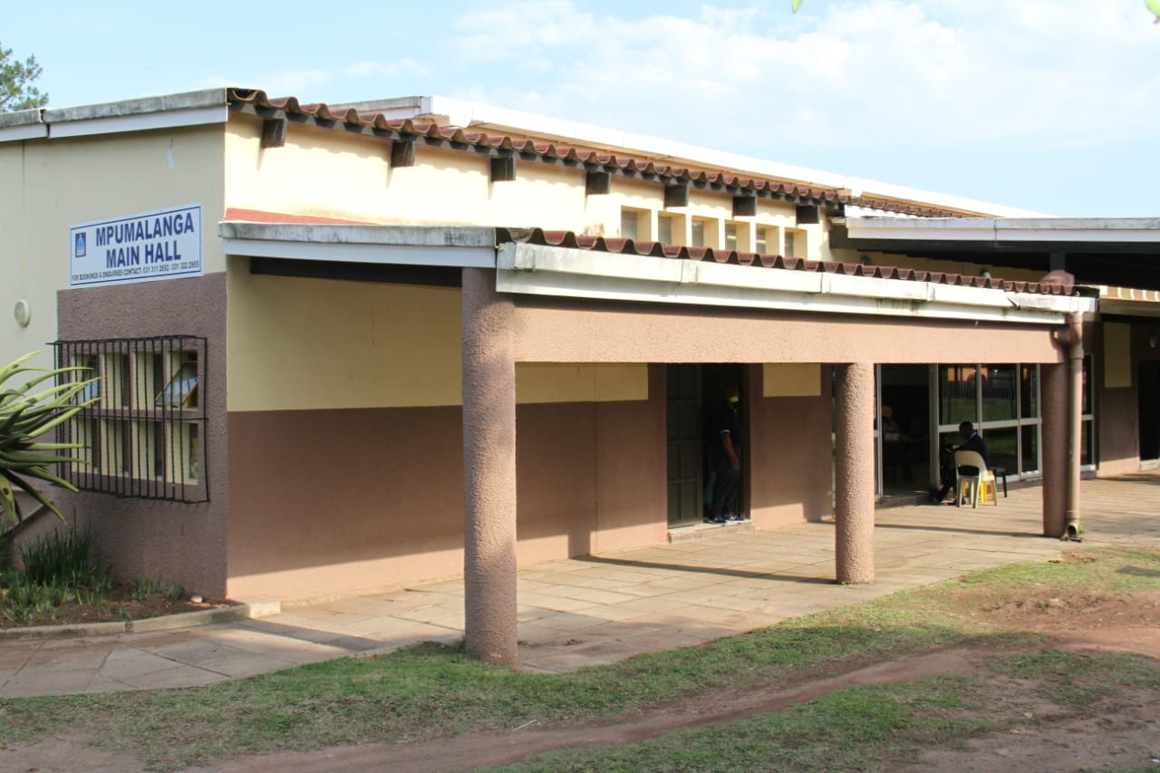
Dullstroom, Mpumalanga in the Emalaheni Municipality District

Dullstroom dates back to the 1880’s and was name after its Dutch founder, Wolterus Dull, and the many Rivers found in the Area, hence the suffix- ‘stroom’, which is Afrikaans for; 'Stream'. Two Farms were purchased, and settlers began to arrive from Holland. However, discouraged by: the chilly air and ‘eternal mist’: the total lack of civilized Housing, Shops and Markets and the poor Agricultural of the Land. Many settlers therefore, returned to Holland. During the Second Anglo-Boer War, the British razed the Village to the ground, destroying all but a few of the original Buildings. Local resident and descendant of one of the original founder, Mrs. Janson, recalls the dramatic call to arms when her husband, now 99, donned his Bandelier before leaving to fight with the Boers. After the war, TNH Janson (Oom Teun) was one of the first to return to Dullstroom and the family played a prominent role in the reconstruction and rebirth of the Village. The Town is richly endowed with a multi-cultural Heritage, and many cornerstones on surviving Buildings, date back to 1890's. The gravestones in the Town Cemetery reflect the diverse cultures - with headstones bearing English, Irish and Boer surnames. The influence of the European settlers can be seen throughout the Village, from the picturesque pointed stone Architecture, Historic Monuments such as the Stone Church in the village square, and the old Post office, to the abundance of beautiful trees such as: Lindens; Beeches; Cherry and other Exotics, brought over by the settlers. Undeniably the most famous of all the Highlands Meander Towns, Dullstroom is a tourist mecca that attracts hundreds of thousands of visitors every Year and is commonly referred to as: ‘Scotland’s Only Outpost in Africa’. Around two hours’ drive from both Gauteng and Nelspruit, Dullstroom makes up the perfect long weekend retreat for people wanting to escape either the Lowveld heat or the noise and pollution of Gauteng! Trout has had a huge part to play in this small Town’s success. Proclaimed a Town by Paul Kruger in 1892 and referred to as the ‘Place of Eternal Mist’ by the first Dutch settlers. Dullstroom had a volatile first few Decades, caught in the cross fire between the Boer and the Brits during the Anglo-Boer war. It was with the release of trout in 1916 and the further stocking of Dams in 1927 that Dullstroom started to make a name for itself in the fishing World and people began to see it as more than just a sleepy Village, in the mist belt. Yet it is this mist belt and the high-altitude setting, that provides Dullstroom with the cool climate and clean air that make it both a tourist magnet and floral oasis. The Town is rich in plant life, with many rare and endemic species being found here including numerous Orchids and the exquisite golden Arum lily, as well as the only substantial populations of Elm and Beech trees. During the spring and summer months the grasslands surrounding the town come alive with an explosion of floral fireworks that turn the green Hills, into a rainbow of colour. It is also one of the few Regions of South Africa where you will find all three species of the endangered Crane. The cooler conditions make perfect Hiking conditions or whether you just enjoy strolls along the riverbanks or stretching jaunts up rocky escarpments, you will find the most breath-taking scenery while being immersed in the silence and tranquillity of this beautiful location! The micro-Climate found here, also provide the perfect conditions for trout to thrive, making Dullstroom another corner of the ‘Trout Triangle’ and one of the ‘must-visit’ fishing hotspots, in South Africa. Yet there is so much more to Dullstroom than simply; Flowers and Fish. The incredible range of Restaurants will ensure even the fussiest of foodies is satisfied and huge array of artisan shops set in the Town’s wonderful 19th and 20th Century Architecture. There is also: Birds of Prey Shows; Clay Pigeon shooting; Horse riding adventures, Mountain bike and trail running routes, art Galleries and Health Spas, you could stay a year in Dullstroom and still not run out of activities to do! It is no wonder that this once ‘sleepy town in the mist belt’ which has now become the tourism hub of the Highlands was a Finalist, in the Kwela’s Town of the Year 2016 Awards. This is a Town that prides itself on being distinctive, original and all inclusive, it manages to cater for the needs of everyone! WHAT AN AMAZING DESCRIPTION OF OUR BEAUTIFUL COUNTRY... IRRESPECTIVE OF WHERE YOU ARE IN THE WORLD NOW! 😍 Author Unknown: I sit here quietly thinking about what it means to me to be South African, a visitor to South Africa, or even African. So it seems easier to rather explain the effect that this unique land has on me... The perfume of rain on African soil. The scent of woodfires drifting across the Highveld on winter evenings. There's a very distinctive aroma just as one starts coming into George / Knysna / Plett (I've never figured out which herb it is), in much the same way the smell of Wild Sage defines the area around Santawani in Botswana. The odour of thatch in a game lodge. The bouquet of dust and the various plants when one gets into the bush, sometimes a whiff of something dead. The tang of the ocean at the seaside. The smell of ‘moer’ coffee over an early morning fire, or the delicious aroma of roasting meat over flames – whether you call it a braai or shisa nyama (but definitely NOT a barbeque, a barbie, or a ghastly NZ sausage sizzle!) There is also something about the light here. “Santorini Blue”... I don’t know if that’s an actual colour, but it seems to describe the hue of the highveld sky on a winter’s day to perfection. We live in “big sky” country – whether blue, or orange in sunset, or dark grey and rent by lightening, or velvet black and filled with stars that seem close enough to touch – the sky is ever present. As is the moon. I am always aware of the moon, from a sickle moon to the full fecund globe that is full moon. Silver light gilding thorn trees, juxtaposed against dark shadows on the savannah, is not a sight one easily forgets. The caw of the ubiquitous, raucous Hadedah in suburbia, the burbling call of a rainbird (Burchell’s Coucal) when a thunderstorm is on its way, the beautiful Diederick’s Cuckoo announcing the arrival of spring, the screech of a Barn Owl, or the evocative call of the Fish Eagle. Jackals calling as the sun goes down, a lion’s roar quite literally making the air reverberate, or the chilling whoops of the hyenas. The cacophony of barking geckos that start up as the sun goes down over Deception Pan, or a veritable orchestra of frogs around a pan in the summer months. Cicadas shrilling on days so hot that the air shimmers, or a nightjar calling in the dead of night in the bushveld. Days of withering heat often followed by the lightest cool breeze, just as the sun is setting. A gentle little wind, which plays with your hair like an absent-minded lover, reminding you that the cool of the night will soon be with you. Walking in the bush very early in the morning, the sun’s rays catch the dew on spiders’ webs, reminding you that life, both seen and unseen, is all around you. Trout fishing as the sun peeps over the horizon in Dullstroom, so cold that the water droplets freeze on your line… The colours of this land are not subtle either. The blood red of the coral tree, the green metallic glint of sunbirds, the striped black and white hide of the zebra, or sapphire blue of a kingfisher. The miles and miles of yellow and orange daisies in Namaqualand in September, or pink and white swathes of cosmos along the roads in April. The lilac and turquoise of the roller, the tawny hide of a lion or the emerald green of a little dung beetle that makes its appearance in the summer months. From the golden dunes of the Namib to an unimaginable number of greens in the Knysna Forest. All vivid and arresting. Talk to me of Morrungulo or Tsodilo Hills, the great Drakensberg, Platteland dorps and the great Karoo. The warmth of Sodwana Bay or the icy kelp forests of the Atlantic Ocean. Of wine farms and fynbos in the Cape, to meerkats and diamonds in the north. Show me our people, in so many hues, with brightly coloured traditional costumes – and even brighter smiles. All of this creates a frisson of excitement, passion each and every day, a vivid, immediate sense of being alive that I have found nowhere else…. These are my people. This is my land. Because I am, at the very core of my being, a child of Africa! ❤️
Geolocation
30° 12' 14.4", -25° 25' 4.8"
References
https://getlocal.co.za/blog/dullstroom-sleepy-country-village-to-major-tourist-attraction http://www.mpumalanga.com/places-to-go/highlands-meander/dullstroom
Further Reading
https://www.newframe.com/trading-on-the-wrong-side-of-white-for-100-years/?fbclid=IwAR0kKFD1ysgYOTWi0lAKR10VrX7Bf-rJg1kX_Zeeo7K2rscIkjkOLeOV0JQ http://www.elandskloof.co.za/ https://www.linkedin.com/pulse/because-i-am-very-core-my-being-child-africa-jacqui-ikin/?trackingId=1fZ0OB16RuGtuKTRzBL0Yw%3D%3D

Parents' Guide for Safe YouTube and Internet Streaming for Kids by Sophie Anderson (1 January 2019)

You work hard to keep your children safe from so many different dangers, but every day they are exposed to countless threats online. Predators, disturbing content, identity theft attempts, and other things you wouldn’t let them experience in real life are all waiting for them.

See here for the full article.

Language

Noordhoek, Cape Town- Southern Peninsula

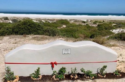
There is some mystery about how Noordhoek came by its name. While there is no doubt that it goes back to the time of the earliest white settlers some time after Jan van Riebeck arrived in the Cape in 1652, it is not certain whether the name simply refers to the Northern corner of the Fish Hoek/Kommetjie Valley, as common sense might suggest, or as some would have it, is a reference to the powerful Northern winds, which sweep off the South Atlantic in Winter, or even is a corruption of 'Norwegian Corner'; though why it should have been called this, is not clear! The most likely explanation is that the name refers to its Geographical position. Other suggestions give cause for romantic speculation! Archeological remains in middens and skeletons have revealed that the Valley has been inhabited for well over a thousand Years. The original inhabitants were Khoi nomads and Strandlopers who lived on, what the sea provided. The most dramatic, though not the highest Mountain in the range that forms the Valley’s Northern boundary is Chapman’s Peak (547 meters). Noordhoek Peak is the highest point at 754 meters. Chapman’s Peak was named after John Chapman, a lieutenant in the Royal Navy who went ashore in 1607 to find water, in what was to be called Chapman’s Bay. Jan van Riebeck renamed it Houtbaai 40 Years later. The name was not lost however, as it was transferred to the next bay further South, where today the rocks on the right-hand corner are known as: 'Ratelklip'. In other words, the magnificent 8km Noordhoek Beach forms the landward perimeter of the Bay, ending at the rocks where the Wildevoël Vlei, enters the sea. The name; Ratelklip, is preserved in the very last Road leading off Beach Road just before the car Park. Chapman’s Bay is therefore one of the oldest place names, in South Africa. The Noordhoek Valley is bounded in the North by Chapman’s Peak, Noordhoek Ridge and the sweep of Mountains which make up the Steenberg Plateau, towards Muizenberg, all of which form a magnificent Natural amphitheater! For many Years, Noordhoek was a fairly remote and inaccessible corner of the Southern Peninsula, until the Ou Kaapse Weg, was completed in 1960's. The only access for nearly 300 Years was via the main Road that follows the Railway Line, along the False Bay shore from Muizenberg via St James, Kalk Bay and Fish Hoek to Simon’s Town. It was not until 1923, that the scenic Chapman’s Peak Drive which links Hout Bay to Noordhoek was opened. The only way over the Mountains was little more than a track from Kalk Bay to Hout Bay. Consequently, Noordhoek was for many years cut off from the main Urban development of the Southern Peninsula. Since the Ou Kaapse Weg was completed, however, the Valley has not been spared the ravages of Urban development, which is in danger of destroying the very qualities that made Noordhoek attractive to start with! Namely, its rural Landscape and natural beauty, (which is now a mere 30 minutes from the heart of Cape Town.) It all began when Noordhoek Farm was proclaimed in 1743, by governor-general Van Imhoff who granted the land to Christina Diemer who married Frederik Rossouw and inherited the Farm; 'Zwaanswyk', when he died. She also owned, 'Imhoff’s Gift' and extensive piece of Land, in Simon’s Town. The second owner was; Izak de Villiers who took possession of the Land, roughly 190 Years ago. In 1793, Jakob Malan built a House not far from the present gateway, to the Noordhoek Manor House. In 1821 much of present day Noordhoek was sold to Jacobus Hurter for less than £1000. Other settlers of that period were Alexander and Joseph Hare, Robert Scott, William Fairlie and Isaac de Villiers. The de Villiers's family has been associated with the Valley for many Years. A descendant of the first Huguenots arrived from France in 1687, settled in the Noordhoek Valley in 1881. During this time of sailing ships, Noordhoek was well known for many Years for providing the 'men-of-war', in Simon’s Town with fresh vegetables. More recently, Sir Drummond Chaplin, a protégé of Cecil John Rhodes and MP for the South Peninsula seat, for the South African Party, bought 330 acres of Forest on the Mountain side. This Land was destined to become much of the present day De Goede Hoop Estate, which took its name from Christina Rousseau’s original Farm. Sir Drummond’s Manor House was designed by one of South Africa’s most famous Architects, Sir Herbert Baker. The foundation stone was laid by Prince Arthur, of Connaught. The power of Community is palpable in Noordhoek, as a Community collaboration project has come to fruition. Earth & Co along with Project Noordhoek unveiled a new beachside bench built entirely out of EcoBricks! (The Noordhoek Community has always had a deep minded concern for the Environment and their Natural surroundings). The Community has created a bench on the Beachfront which according to Earth & Co.’s Facebook page, was crafted from 800 EcoBricks, amounting to 400 kgs of plastic and non-recyclable waste! The EcoBricks were collected from and contributed by the Noordhoek community.

Eco Bench, at Noordhoek Beach Parking Lot Image Source
Geolocation
18° 20' 45.6", -34° 5' 56.4"
References
https://www.neag.org.za/noordhoek-history/ https://www.capetownetc.com/cape-town/ecobrick-bench-unveiled-at-noordhoek-beach/ https://www.falsebayecho.co.za/news/bench-in-memory-of-wesley-sweetnam
Further Reading
http://www.neag.org.za/ https://www.news24.com/news24/SouthAfrica/Local/Peoples-Post/eco-brick-bench-built-in-memory-of-trail-runner-20200309 https://saeis.saeon.ac.za/Archive/Literature/Reports/GreenSeries/Report_27_Wildevoelvlei_and_Noordhoek.pdf http://www.enviropaedia.com/company/default.php?pk_company_id=380 http://izwa.org.za/