Shirish Nanabhai

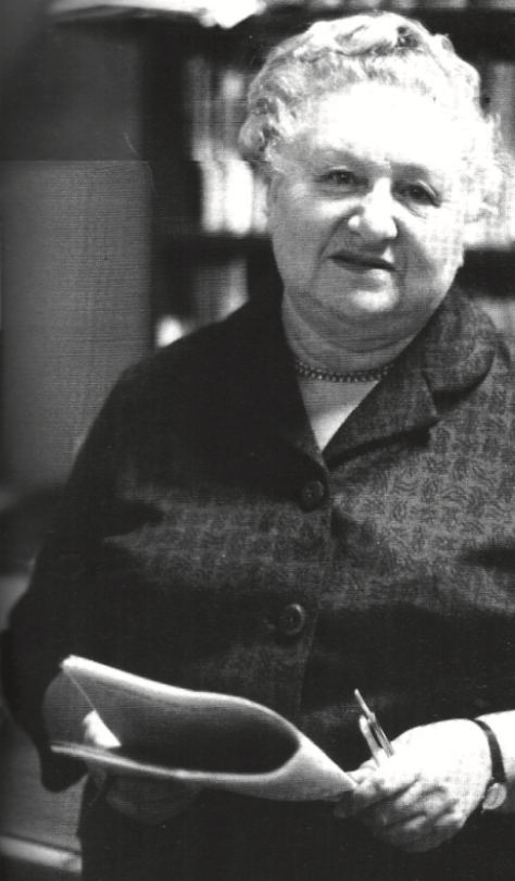
Shirish was born one of eight siblings on 1 March 1938 at 51 Commercial Rd, Fordsburg. Jasmath Nanabhai, Shirish J. Nanabhai’s father, was from the village of Karadi/Matvad in Gujarat, India. Jasmath immigrated to South Africa after the turn of the last century. In a way, it was inevitable that Shirish would get involved in politics because Jasmath was active during his youth in the Indian National Congress, which had fought against British rule in India.

Vergelegen Wine Estate

Vergelegen Wine Estate is situated in an exclusive upmarket Area of Somerset West, about 50 km East of Cape Town. The Area was named after Lord Charles Somerset in 1819, and in 1825 was named Somerset West to differentiate from Somerset East, a small Town in the Eastern Cape.

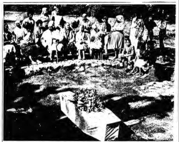
Vergelegen was known as the Country Residence of: Governor Willem Adriaan van der Stel, during the eighteenth Century. He named it ‘far away’, which is a direct translation of the name of the Estate from Dutch. This was due to the long distance from Cape Town to Somerset West. In 1987, Anglo-American Farms Limited (AmFarms) bought Vergelegen from Tom Barlow, who took over in 1966 from his father Charles ‘Punch’ Barlow. Their family had been in charge of the estate since 1941, a Year after the death of Lady Florence Phillips, whose husband Sir Lionel Phillips had owned Vergelegen between 1917 and 1941. Much of the reconstruction of the Estate took place during the time the Phillips Family owned it.

Geolocation
-34° 4' 38.2393", 18° 53' 20.4"
References

A. Markell, ‘Vergelegen: Slave Archaeology at the Cape’, Crossmend 1(1), 1991, 1.
E. van Rensburg, ‘Flora the slave’s reburial today’, Cape Times (8 April 1991).

J. C. Sealy, A. G. Morris, R. Armstrong, A. Markell and C. Schrire, ‘An Historic Skeleton from the Slave Lodge at Vergelegen,’ Historical Archaeology in the Western Cape 7, 1993, 84.

J. Pastor, ‘Archaeology, Museology and Education: A case-study at Vergelegen’, (UCT. M.A. Thesis. 1993), 38.

Vergelegen, ‘Phillips Era’, (2018), http://www.vergelegen.co.za. Accessed 22 November 2018.

W. de Bruin, ‘Vergelegen: a perfect blend of past and present’, Restorica 28, 1994, 22. 

https://vergelegen.co.za/
https://vergelegen.co.za/heritage/

Kakamas, Northern Cape

Kakamas is a rather small town situated in the Northern Cape of South Africa. This interesting town was originally built by a church and named after the Khoi word for ‘poor pasture’. The name “Kakamas” poorly reflects on a fertile valley in the lower Orange River, graced with vineyards, cotton and Lucerne fields. Legend has it that grazing in the vicinity was poor and, when cattle were driven through the river’s drifts, some consistently turned on their drivers. To others, the town’s name originates from the Khoi word, “gagamas” (brown), referring to the red clay of the area with which women smear their faces. This lovely town was built on the sheer hard work and determination of a few impoverished stock farmers at the end of the 19th century. In 1897, the Dutch Reformed Church started a colony on the farms 'Soetap' and 'Kakamas' on the banks of the gorgeous Orange River for white people who had lost everything as a result of the drought. Each farmer helped build an irrigation project, and was rewarded with a plot of land irrigated by the resulting canals and tunnels. Despite the criticism they received from qualified engineers about their building methods, the farmers continued to construct the water canals by hand. Today, they are still used to supply the town and surrounding areas with water for irrigation. Two tunnels of 3-4m high, 2,5m wide and 97m and 172m long, were dug by hand as part of the canal building project and were completed in 1911. Many of these fascinating tunnels can be explored by visitors.
Geolocation
20° 23' 24.36", -28° 44' 2.4"
References
https://www.kakamas.co.za/

Pofadder, Northern Cape

Pofadder is a small town situated in the Northern Cape of South Africa. While pofadder means, as you would expect, puff adder (a type of snake) this town was named not for a scaly reptile but after a certain Korana chief, Klaas Pofadder, who lived on Kanoneiland and died in the area when he was gunned down by local farmers. In 1918 the name was officially changed to Theronsville, but the original name stuck and was eventually re-employed. Each year, in August, Pofadder makes an ideal base for exploring the surrounding area which is covered with a carpet of Namaqualand daisies following the rains. Pofadder has several old buildings, including a Roman Catholic Church which was built by the mission. Today it runs a block making enterprise, chicken farm and a dairy, which offers employment to the local communities. In much the same way as we refer to places off the beaten track as being in Timbuctoo, South Africans often use the name of Pofadder to similar effect to refer to any far-flung small town backwater. The very little town of Pofadder lies surrounded by rugged, sparsely populated and very scenic countryside. Here locals make their money from sheep or goats farming, and there seems little more to entice you to visit the town than its position on the main route from Upington to Springbok, just 60 kilometres from the Namibian border post. Surrounding towns have equally sleepy backwater sounding names, like Aggeneys, Kakamas and Pella but there is something about this parched countryside that is appealing and, certainly in spring, the blanket of incredible flowers that brighten this part of the world makes a visit here worth the drive. Pofadder is, in fact a great place to overnight and the wee town provides a more than welcome break from endlessly straight roads through the Kalahari plains. Pofadder has quite a history too. It might be little more than a couple of tar roads, a café, church and hotel, but there was quite a resistance mounted by the original Koranna people (offshoots of the Khoi-Khoi) who made this part of the country their home back when a mission station was set up here in 1875. A few fresh water springs, called the Koranna springs, were what attracted these people here originally, and a town soon followed in 1918, officially called Theronsville. Pofadder, however, stuck, and the official name soon followed suit and reverted. In August this is a great little base from which to explore the Namaqualand daisies, and there is a hiking trail, called the Pofadder hiking trail, in the vicinity. For the adventurous Two guided trails of 25 km, wind around the dunes, mainly traversing the spines and offering panoramic views over the plains for either 4x4 Vehicles or Quads. During the winter rain season these plains are covered in colourful Namaqualand flowers. Duration of the route varies between 2 - 5 hours, depending on the number of vehicles. Single as well as group bookings are welcome with a maximum of 12 vehicles. A lovely 4x4 experience in the Bushmanland for all sand lovers between rich, red dunes interspersed with rocky outcrops rising above a sea of grassy plains. Camping site available with hot shower, running toilet, braai facilities and shaded camping areas. The route caters for drivers of various levels of experience with interesting technical challenges.
Geolocation
19° 19' 58.8", -29° 9' 32.4"
References
https://www.portfoliocollection.com/travel-blog/how-pofadder-got-its-name a-venues.com/attractionsnc/pofadder.php
Further Reading
https://www.sa-venues.com/things-to-do/northerncape/bysuburb/pofadder/ https://www.sa-venues.com/things-to-do/northerncape/4x4-trails-with-dinkys-dunes/

Springbok, Namaqualand

Namaqualand's largest town, is Springbok. You can enjoy the wild flowers and dramatic landscapes of the Northern Cape, a South African destination that stands apart for its rugged beauty. The pretty town of Springbok is found in the heart of the Namaqualand within spitting distance of other typical Namaqualand towns like Alexander Bay, Pofadder, Garies, Kleinzee and Port Nolloth, 570 kilometres north of Cape Town. Originally called Springbokfontein, Springbok is the administrative capital of the region as well as the last major town in South Africa on the only main road north, before the border into Namibia. Springboks perfect position as a stopover en route to Namibia and its repute as the flower capital of Namaqualand have placed Springbok on the map. It’s not difficult to imagine the prominence of Springbok antelope in the narrow valley wedged between the high granite domes of the Klein Koperberge (copper mountains) that must have lead to the town’s rather obvious name. By all accounts the attractive town of Springbok is formed around a central koppie or hill, known by locals as ‘klipkoppie’ (stone hill) that was used by the Boers during the Second Boer War as a fort for its incredible vantage point. Views from here across the valley are beautiful, as are the examples of flowers during spring every year that not only blossom on the little hill but in the surrounding scrubland as well. The koppie is also the site of a modest stone church built in 1921 and the remains of the walls of the original fort. There’s enough reason to spend a couple of days here to visit; the Skilpad Wildflower Nature Reserve, particularly in August and September, the Augrabies Waterfall, the Goegap Nature Reserve, the Blue mine - Springbok’s first mine, and the war graves from the Anglo Boer War.
Geolocation
17° 51' 3.6", -29° 39' 25.2"
References
https://www.sa-venues.com/attractionsnc/springbok.php
Further Reading
https://www.ancestors.co.za/all-saints-namaqualand/