Kranskop, KZN
The rather little Village of Kranskop lies just 36km North East of Greytown in the Midlands of KwaZulu Natal. In Afrikaans a 'kop' means a 'Peak' and because rests in the shadow of a rocky ridge that is undoubtedly the reason for its name change from the original 'Hopetown'. Kranskop's rocky escarpment is something of a landmark, a feature of the landscape, towering 1175 metres over the Valley below. The Village may have been here since 1894, the sandstone outcrop with its two openings has been an integral part of Zulu local folklore for far longer. Tales involve; cannibals who were said to have the power to open the mountain and coax passers-by inside. The Zulu name for it is aptly 'Ntunjambili' – rock with two holes.
Kranskop features on: 'The Amble'; a route that principally follows Route 33 from Pietermaritzburg through the North East Midlands. But which also stretches to incorporate little towns like; Harburg, Ashburton, Wartburg, Claridge and Dalton.
From Battlefield sites of the Anglo-Boer War to historical churches, outdoor wilderness, waterfalls and birding sites, The Amble includes a series of activities, wildlife and History.
Geolocation
30° 51' 21.6", -28° 58' 4.8"
References
https://www.sa-venues.com/attractionskzn/kranskop.php
Further Reading
http://www.kznhealth.gov.za/Untunjambili/history.htm
https://eshowe.com/ntunjambili/
https://www.wheretostay.co.za/topic/3363-ntunjambili-kranskop-peak-
https://www.sa-venues.com/attractionskzn/greytown.php
https://www.n3gateway.com/the-n3-gateway-route/the-midlands-amble/
Hlobane, Zululand District Municipality
The name is of Zulu origin, it is said by some to mean ‘beautiful place’, and by others ‘place of dispute’. Roughly 26km east of Vryheid, lies the rural village of Hlobane – little more than a train station and a local school.
Like much of the countryside in this part of KwaZulu-Natal, the area is home to a Battlefield that lies at the foot of the Hlobane Mountain.
Hlobane was the site of a British disaster in March 1879 when mounted troops led by Lt. Col. Redvers Buller, tried to ambush the Mountain, then a hiding place of the abaQulusi people, descendants of the Zulu royal homestead, abaQulusi (loyal to the Zulu crown and part of the resistance to the British invasion of northern Zululand). The abaQulusi lived in homes in the Valley below, but when threatened they and their cattle would head up the narrow paths to the summit of the Mountain, a rather uneven, flat-topped plateau.
Walking Hlobane is best left for toughened hikers and hill-walkers, as the track onto the summit is no longer maintained now that the coal mine is closed.
But the walk is worth it as the scenery from the summit of the Mountain is said to be breath taking, somewhat peaceful!
A visit to the battlefield, then, involves a guide and permission from the private Mine on whose property Hlobane Mountain and the Battlefield now rest.
Geolocation
30° 59' 2.4", -27° 42' 39.6"
References
"Dictionary of Southern African Place Names (Public Domain)". Human Science Research Council. p. 211.
https://www.sa-venues.com/attractionskzn/hlobane.php
https://www.historynet.com/anglo-zulu-war-battle-of-hlobane.htm
Further Reading
http://www.vryheidtourism.co.za/24-vryheid/49-abaqulusi-what-s-in-the-name
https://www.howtopronounce.com/hlobane
https://www.battlefieldsregionguides.co.za/place/hlobane-battlefield/
https://www.historynet.com/anglo-zulu-war-battle-of-hlobane.htm
https://www.mineralscouncil.org.za/industry-news/we-care-we-remember/509-we-remember-hlobane
https://www.sa-venues.com/attractionskzn/gingindlovu.php
https://www.sa-venues.com/things-to-do/kwazulunatal/hiking-the-hlobane-mountain/
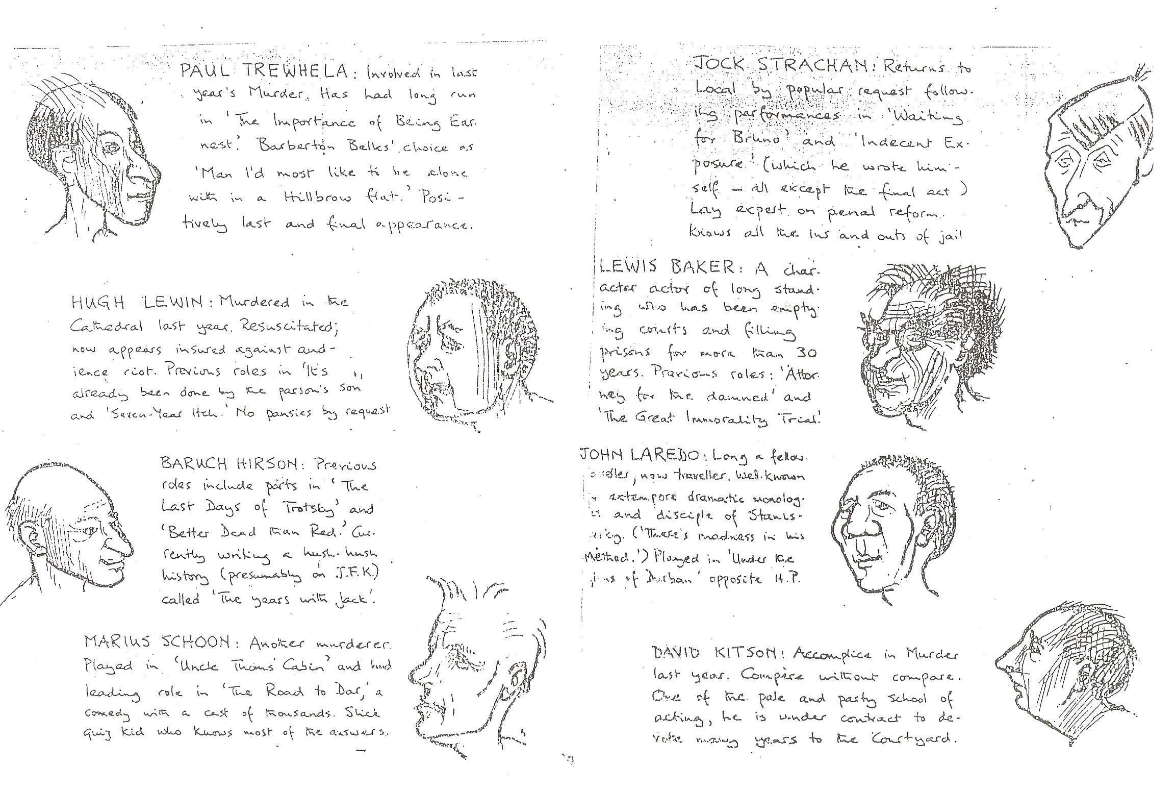
Playbill for Shakespeare's Henry IV at Pretoria Local Prison - New Year's Eve in 1966 - Inner Page - Art by Harold Strachan

Inner page of a playbill for the single production of two scenes from Shakespeare's Henry IV, Part I by political prisoners in Pretoria Local Prison whom the authorities allowed to put on - New Year's Eve, 1966 - Paul Trewhela
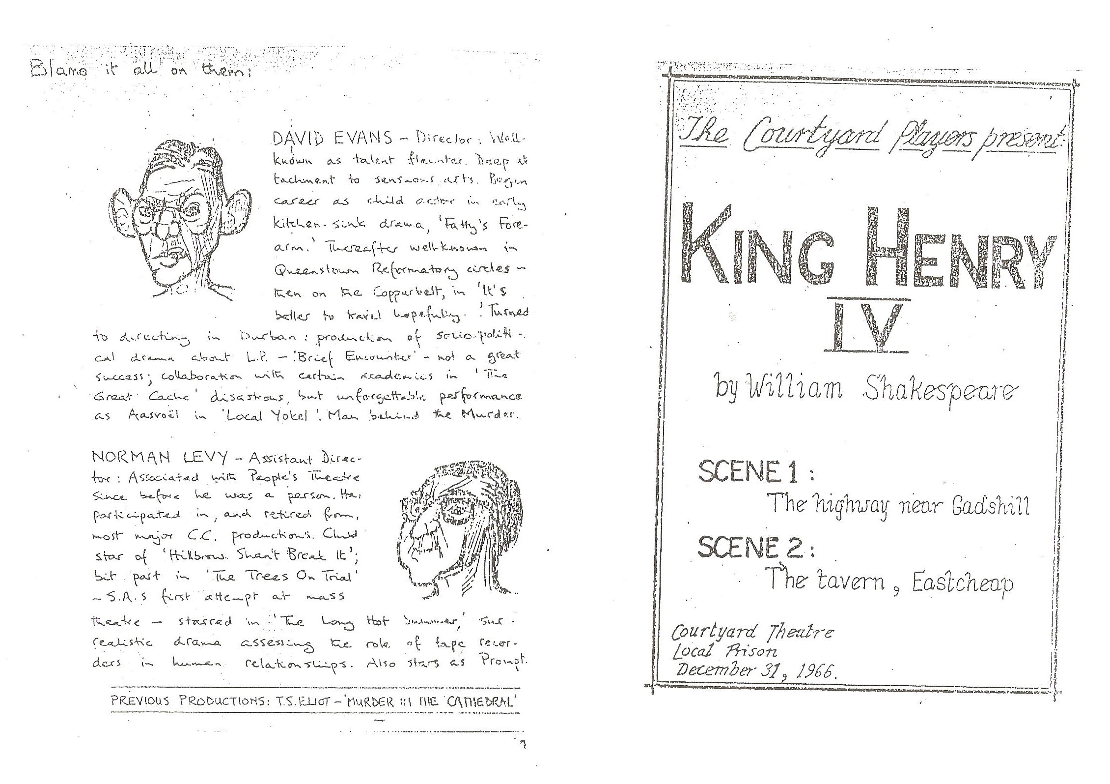
Playbill for Shakespeare's Henry IV at Pretoria Local Prison - New Year's Eve, 1966 - Outer Page - Art by Harold Strachan

Outer page of a playbill for the single production of two scenes from Shakespeare's Henry IV Part I that political prisoners in Pretoria Local Prison were allowed to put on for themselves on New Year's Eve, 1966 - Paul Trewhela
Grade 11 Topic 3 – Source-Based Questions


An image showing the persecution of German Jews after the Nazi took powerImage Source
Source 3A
The source below shows how the Nuremberg laws affected Jews living in Germany

