1973 Durban Strikes Celebrating 50 Years Conference - Papers Submitted

These papers were submitted to the 1973 Durban Strikes Celebrating 50 Years Conference
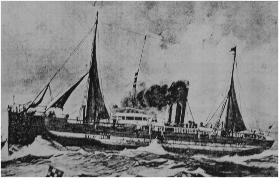
SS Clan Stuart

The SS Clan Stuart was blown ashore in 1914 between Glencairn and Simon's Town, along Cape Town’s west coast. The SS in the vessel's name stands for ‘steamship’. This steamship was built by W. Doxford and Son in 1900, in Sunderland, England (Barnardt, 2013). It was a triple expansion steam engine ship, weighing 3,594 tons, but it was not designed to withstand strong weather conditions (Barnardt, 2013). This design meant that most of the ship would be below the waterline, the method has become known as the turret deck principle (Mitchell, n.d.).
Zeitz Museum of Contemporary Art Africa- (MOCCA)
Zuurberg Mountain Village (also spelt:"Suurberg")
Lying in the North Western corner, of the Sundays River Valley, Zuurberg lies at the foot of the Mountain of the same name. The Historic Zuurberg Pass, almost entirely surrounded by the Greater Addo Elephant National Park, is a narrow cutting through the Zuurberg Mountains, built in the 1850's and the original main route into the hinterland via which today, you can also reach the Karoo.
The pass was built in 1850 and was the only road to the North, from Port Elizabeth for anyone travelling towards Grahamstown, Somerset East, Colesburg and Kimberley. This long and sometimes extreme gravel Pass is located on a secondary road (the R335) in the Eastern Cape, approximately 35 km North of Addo and 75 km South of Somerset East. At 27,5 km it is one of the longer Passes in South Africa and traverses all four tiers of the dominant Zuurberg Mountain Range.
It was originally constructed by Henry Fancourt White in 1849, but White resigned during the construction phase to take up a post in parliament, leaving the project in the capable hands of the assistant roads engineer, Mr. Matthew Woodifield, whose name appears carved into a rock slab near the Southern end of the Pass.
The Pass contains within its length 158 bends, corners and curves. As progress is made Northwards, the road surface deteriorates to the point where low range and high clearance is required. Allow two hours (excluding stops) to complete the Pass and be patient and careful as this is true puncture Country. (Changing a spare wheel on a steep incline is a risky affair, so it's better to drive slower and choose your driving lines with care!)
The Mountain overlooks the Rolling Hills of this part of the Eastern Cape. In the heart of Valley bushveld and fynbos types, unique to the Eastern Cape. The former Zuurberg National Park, on the slopes of the Mountains stretching towards Darlington Lake, which now lies within the Greater Addo National Park.
An important Late Stone Age, Archaeological Site lies at the Melkhoutboom Cave in the Zuurberg Mountains, which has uncovered artefacts dating back some 15 000 Years. Contributing greatly to our overall picture of the life and times of the prehistoric hunter-gatherers.
Steynsburg
https://www.eastern-cape-info.co.za/provinces/town/617
https://www.hikingsouthafrica.co.za/amatola-hiking-trail/
https://www.komoot.com/guide/257432/attractions-around-steyerberg
https://www.sa-venues.com/visit/hillstonfarm/
https://www.sa-venues.com/things-to-do/easterncape/bysuburb/steynsburg/
https://www.theheritageportal.co.za/thread/bulhoek-steynsburg
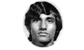
Krishna Rabilal
Krishna Rabilal was born on 6 November 1952 to working class parents in the township of Merebank, south of Durban, Natal (now KwaZulu-Natal – KZN).
A quiet and unassuming person, Rabilal was a brilliant student, excelling in both mathematics and physical science. He hated the Afrikaans language, calling it the language of the oppressor. He felt so strongly about this that he refused to study Afrikaans on principle.

South Africa’s Marikana 10 years on: survey shows knowledge of massacre is low, by Benjamin Roberts, Jare Struwig and Steven Gordon (theconversation.com), 16 August 2022

To explore the patterns of collective memory in South Africa after nearly three decades of democracy, we set out to establish how much of the country’s recent history people in the country still remember.